


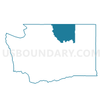
Janis Voting District, Okanogan County, Washington
About
Outline

Summary
| Unique Area Identifier | 687716 |
| Name | Janis Voting District |
| County | Okanogan County |
| State | Washington |
| Area (square miles) | 0.77 |
| Land Area (square miles) | 0.62 |
| Water Area (square miles) | 0.15 |
| % of Land Area | 81.01 |
| % of Water Area | 18.99 |
| Latitude of the Internal Point | 48.66388000 |
| Longtitude of the Internal Point | -119.47649950 |
Maps


Graphs
Select a template below for downloading or customizing gragh for Janis Voting District, Okanogan County, Washington


Neighbors
Neighoring Voting District (by Name) Neighboring Voting District on the Map
- Aeneas Creek Voting District, Okanogan County, WA
- Aeneas Lake Voting District, Okanogan County, WA
- Bonaparte Voting District, Okanogan County, WA
- Cayuse Mtn Voting District, Okanogan County, WA
- Frontage Voting District, Okanogan County, WA
- Gusty Ridge Voting District, Okanogan County, WA
- Highway Voting District, Okanogan County, WA
- North Tonasket Voting District, Okanogan County, WA
- Tonasket 2 Voting District, Okanogan County, WA